History can play a critical role informing every generation’s decisions. Accurate, informed knowledge and intelligence can shape front-line decision-makers lives as they deal with everyday challenges. Larger challenges, even existential challenges — and crisis require best available intelligence. To illustrate, let’s look back at the origins of U.S. climate and earth science
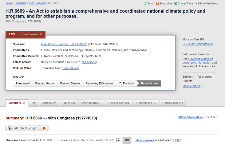
George E. Brown and the Beginnings of the First Decades of the Science, Space & Technology Committee
Visionary Earth Science Action Over Three Decades — a Mission from the 20th to the 21st Century
Strategic Demands Editor:
In the mid-1960 I was fortunate to meet and begin a multi-decade friendship with a new Congressman from East Los Angeles. Representative George E. Brown.
Here, take a look at an overview and personal memory of my friend George’s work in the U.S. Congress over the 1970s, 80s, and 90s until his untimely death in 1999.
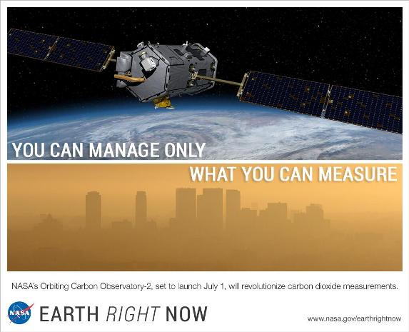
The multiple programs, federal departments, agencies, offices that George was instrumental in their formation, the initial generation of NASA and NOAA earth science research, LANDSAT and an array of data measuring and monitoring of atmospheric- a and terrestrial-systems, oceans, forests…. the existential warnings of the first federal climate study and call to action — all had George’s hand in their creation.
Let’s look closer, beginning with a 2021 hearing before the current U.S. Committee on Science, Space & Technology. Let’s look how the data and systems, a foundation put in place over the past half century are today providing the knowledge, information and capabilities to manage the effects of climate change — in this case ‘wildland fire incidents’.
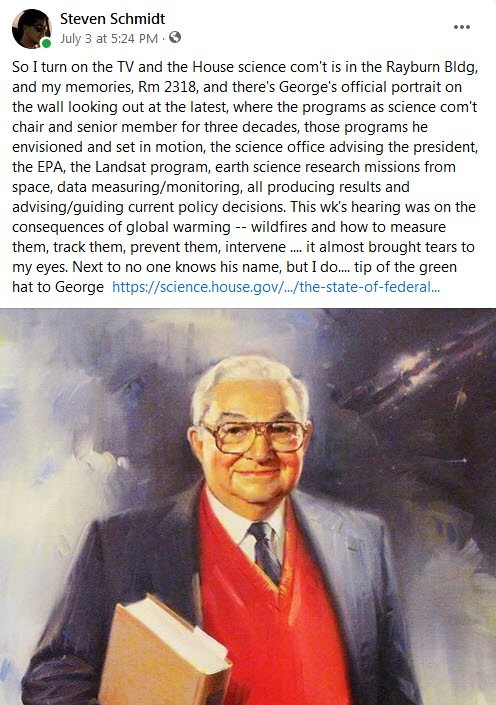
So I turn on the TV and the House science com’t is in the Rayburn Bldg, and my memories, Rm 2318, and there’s George’s official portrait on the wall looking out at the latest, where the programs as science com’t chair and senior member for three decades, those programs he envisioned and set in motion, the science office advising the president, the EPA, the Landsat program, earth science research missions from space, data measuring/monitoring, all producing results and advising/guiding current policy decisions. This wk’s hearing was on the consequences of global warming — wildfires and how to measure them, track them, prevent them, intervene …. it almost brought tears to my eyes. Next to no one knows his name, but I do…. tip of the green hat to George E. Brown —
_________
June 2021
The State of Federal Wildland Fire Science:
Examining Opportunities for Further Research & Coordination
Witnesses:
Dr. Craig B. Clements, Professor of Meteorology and Director of the Wildfire Interdisciplinary Research Center at San José State University
Dr. Jessica McCarty, Assistant Professor of Geography and Director of the Geospatial Analysis Center at Miami University
Mr. George Geissler, State Forester and Deputy for Wildland Fire and Forest Health and Resiliency at the Washington Department of Natural Resources
and
Fire Chief Erik Litzenberg (Ret.), Chair of the Wildland Fire Policy Committee at the International Association of Fire Chiefs [see excerpt of C-Span testimony]
The State of Federal Wildfire Science: Examining Opportunities for Further Research & Coordination
Statement of Fire Chief Erik Litzenberg, Ret.
Santa Fe County Fire Department
presented June 29, 2021
Committee on Science, Space & Technology
U.S. House of Representatives
Good morning, Chairwoman Johnson and Ranking Member Lucas. I am Fire Chief Erik Litzenberg, recently retired from the Santa Fe County Fire Department and current Chair of the Wildland Fire Policy Committee of the International Association of Fire Chiefs (IAFC). I appreciate the opportunity today to discuss the state of federal wildland fire science and opportunities for further research and coordination.
The IAFC represents the leadership of over 1.1 million firefighters and emergency responders. IAFC members are the world’s leading experts in firefighting, emergency medical services, terrorism response, hazardous materials (hazmat) incidents, wildland fire suppression, natural disasters, search and rescue, and public-safety policy. Since 1873, the IAFC has provided a forum for its members to exchange ideas, develop best practices, participate in executive training, and discover diverse products and services available to first responders. America’s fire and emergency services are the only organized group of individuals who are locally situated, staffed, trained, and equipped to respond to all types of emergencies. There are approximately 1.1 million men and women in the fire and emergency service — consisting of approximately 300,000 career firefighters and 800,000 volunteer firefighters — serving in over 30,000 fire departments around the nation. They are trained to respond to all hazards ranging from earthquakes, hurricanes, tornadoes, and floods to acts of terrorism, hazardous materials incidents, technical rescues, fires, and medical emergencies.
Wildland fires are a growing area of operations for local fire departments that are located in rural locations, the wildland-urban interface (WUI), and more developed areas. Last year was one of the worst fire seasons on record. According to the National Interagency Fire Center, there were 58,950 fires totaling more than 10.1 million acres burned. These fires resulted in federal suppression costs of almost $2.3 billion.2 As the American population grows more into the WUI, fires in these areas are proving to be very costly and most challenging to federal, state, tribal, and local authorities….
The NASA’s earth-observing satellites can detect fires, track the smoke from fires, provide information about burn scars to the earth, and provide this information to local fire managers… There are a number of opportunities for further scientific research that can help firefighters as they battle major wildland fires ….
Remote Sensing: It is easiest to suppress fires as soon as they are identified. While there are ground- and air-based remote sensing systems, NASA,
the National Oceanic and Atmospheric Administration (NOAAO, and other federal agencies can provide a satellite-based component to help better identify fires. For example, a satellite-based system can identify fires in low density areas near critical infrastructure. Local fire departments can then be informed of these fires and work to extinguish them. In addition, NASA’s Earth-observing satellites should be able to provide better information about droughts and help target community preparedness efforts. In addition, federal, state, tribal, and local officials can do a better job of utilizing ground- and air-based remote sensing systems to identify the location and growth of fires.
Fire Mapping: Risk mapping is an important tool for preventing and mitigatin wildland fire incidents. These maps identify possible risk characteristics to guide mitigation projects, including hazardous fuels removal projects. Federal agencies can provide assistance in developing more accurate risk maps. In addition, the development of real-time and interactive maps would provide critical assistance to incident commanders during active wildland fire incidents.
Predictive Analytics: The NASA and the other federal agencies also may be able to combine remote sensing and risk maps to develop tools for predictive analytics. Predictive analytical tools could help federal, state, tribal, and local jurisdictions to identify at-risk areas and focus on wildland fire prevention, community preparedness and mitigation activities.
The Use of Unmanned Aircraft Systems (UAS): Drones and other UAS provide several important capabilities to the wildland fire arena. UAS can hover above a fire and track its progress for long periods of time. Infrared cameras on UAS can be used to identify hot spots at night. By combining aerial surveillance with fire maps and predictive analytics, an incident commander may have a greater understanding of the fireground and be able to make better informed decisions to save life and property.
Firefighter Location Tracking: The development of firefighter location tracking is a major goal of the fire service research agenda. While there are efforts to track firefighters in buildings, it remains important to be able to track firefighters in the middle of major wildland fire incidents. These systems will have to be lightweight to address the challenges of responding the fires in remote areas and be able to broadcast signals over long distances in rugged terrain. Ideally, these tracking systems will be able to provide basic health information to identify when firefighters may need to take time for rehabilitation during major fires. Uniform Data Collection: The IAFC recommends that the federal agencies develop a standardized data collection system, including formatting and methodology to capture and report wildland fire data. This data should include mitigation, prevention, and post-fire recovery efforts. Without a standardized system, it is hard for incident commanders and emergency managers to review information, compare it, and make the appropriate decisions based on the federal data. A Standard Warning System for Wildland Fires: The IAFC recommends that FEMA, NOAA and NIST work with the Wildland Fire Leadership Council (WFLC) and emergency management agencies to develop a standard warning wildland fire scale that relates to the magnitude of current and expected wildland fires. This scale would be similar to a Richter scale for earthquakes or the Saffir-Simpson scale for hurricanes and could relate the magnitude of the pending threat to communities. In addition, this standardized warning system would help communities plan for evacuation.
Interoperable Communications: Interoperable communications remain a challenge on the fireground during wildland fires. In some cases, mobile devices may not get coverage and radios may not be interoperable between neighboring jurisdictions. As the amount of data available to an incident commander broadens to include interactive risk maps, images for UAS, and location information about wildland firefighters, it is important that the incident commander can access this information and distribute it to the personnel in field. I would like to recognize the First Responders Network Authority (FirstNet) efforts to create a nationwide public safety broadband system that will operate even during rural wildland fires. We urge the federal agencies to work with FirstNet to ensure that information like National Weather Service fire weather reports can be broadcast through FirstNet to the incident commanders and firefighters on scene.
# # # #
StratDem Editor: “Measure to Manage” was a core belief and mantra of Rep. George E. Brown, longtime member and chair of the U.S. House Committee on Science, Space & Technology. As a trained engineer, he believed in science, in facts, in data in order to guide decisions, and policy.
George’s hand was on most all of the original earth science missions.
Today, in 2021, I can assure our readers of Strategic Demands that George’s voice is still resounding as we watch today’s generation of earth science missions at work.
A tip of our Strategic Demands / GreenPolicy360 hat to his memory. George’s vision and work is active and still alive providing critical intelligence for today’s generation.